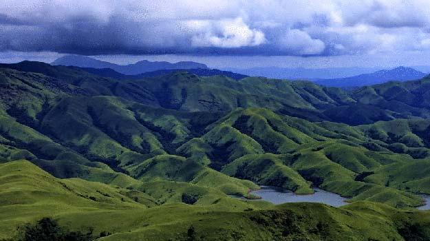
Kuduremukha, located in Karnataka, is a mountain range and name of a peak situated in Chikkamagaluru district, about 95 kms from Mangalore. Overlooking the Arabian Sea, it gets its name from the unique shape of its main peak, which resembles a horse's face ('Kudure Mukha' in Kannada). Standing at an altitude of 1,894 meters, it is the second-highest peak in Karnataka and a premier destination for trekkers and nature lovers.
Historically known for iron ore mining operated by KIOCL, the region features a well-planned township with excellent guest houses. Today, it is a protected biodiversity hotspot nestled within the Kudremukh National Park, known for its dense forests, rolling grasslands, cascading waterfalls like Hanuman Gundi, and rich flora and fauna.
Horse-face peak, scenic trekking trails, biodiversity, waterfalls, and rolling grasslands
👕 Dress Code & Rules
Comfortable trekking clothes, sturdy grip shoes, and leech socks during monsoons
Forest entry and trekking fees apply as per Karnataka Forest Department rules
Available at the base camp and forest office check-points
Local eateries available in Kalasa and Kudremukh town area
6:00 AM – 6:00 PM (Trekking requires prior permission from the Forest Department)